ESA Living Planet Symposium 2025 Recap
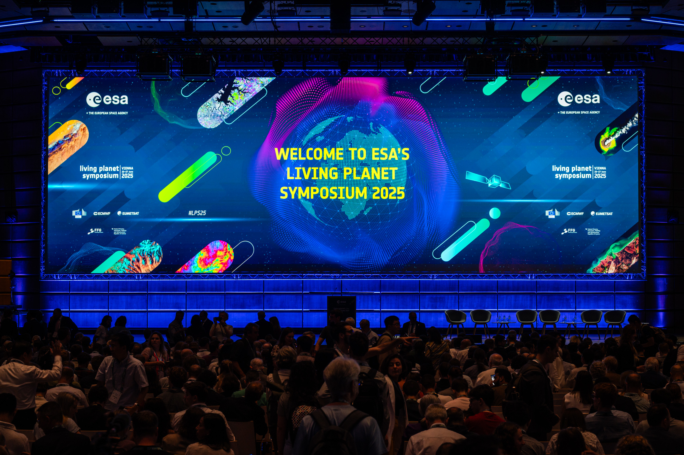
Recently the European Space Agency’s (ESA) Living Planet Symposium (LPS) was held in Vienna, Austria. This was likely the world’s largest gathering of the Earth Observation community. The LPS website claims there there were 6500+ registered participants and 4200+ presentations & posters in 250+ sessions, but those are conservative numbers… I counted 4428 presentations & posters in 453 sessions. Also it says there were 2300 “Children at the School Activities”, and I can confirm there were lots of kids at the conference (and on the metro). Awesome to see!
I attended LPS on behalf of Radiant Earth and the Cloud-Native Geospatial (CNG) Forum. I was there to learn how CNG specs and tools are being adopted by the Earth observation community and to help build awareness. Given the size of the conference (it had 30 separate content tracks!), my first challenge was to determine what content would be presented where and at what time, in order to plan out where I should be throughout the week. Unfortunately, the LPS conference website with its limited search functionality wasn’t up to the task, so…
… a scraping we will go
I ended up scraping the entire LPS programme (I’ll go along with the British spelling) web pages to create a list of items (sessions, presentations, posters, etc.) that mention CNG-related terms.
There turned out to be 142 programme events (3.2% of all events) that mentioned one or more CNG terms. Broken out by term:
| Term | # Programme Items | % of all |
|---|---|---|
| STAC | 86 | 1.9% |
| cloud-native | 50 | 1.1% |
| Zarr | 43 | 1.0% |
| COG | 21 | 0.47% |
| Pangeo | 15 | 0.34% |
| Parquet | 8 | 0.18% |
| Kerchunk | 3 | 0.07% |
(I also searched for flatgeobuf, pmtiles, and copc but didn’t find any use of these terms.)
What to make of this?
- The STAC spec is being adopted, with many groups using it to catalog their imagery assets in a standardized way.
- While COGs have been around for quite a while and are commonly used for sharing imagery, there is considerable interest (i.e. twice as many events) in the Zarr format for Earth observation. I don’t think this means that the Zarr format is preferred to COGs, or used more often, but rather that using Zarr for Earth observation data is new and an interesting topic to present on.
To help myself and others find these sessions, I created a public web page that listed all of the CNG-related events. And since this turned out to be quite useful approach for searching general LPS content, I also created a page with all of the events.
CNG social
Like any good conference, a lot of the value in attending comes from the opportunity to meet others with common interests. In order to facilitate networking, we organized the Cloud-Native Geospatial Community Social, an evening networking event sponsored by Radiant Earth, Development Seed, ThriveGeo, and EOX. The event was hosted at a local gastgarten, in a beautiful narrow room supplied with plenty of Austrian snacks and drinks.
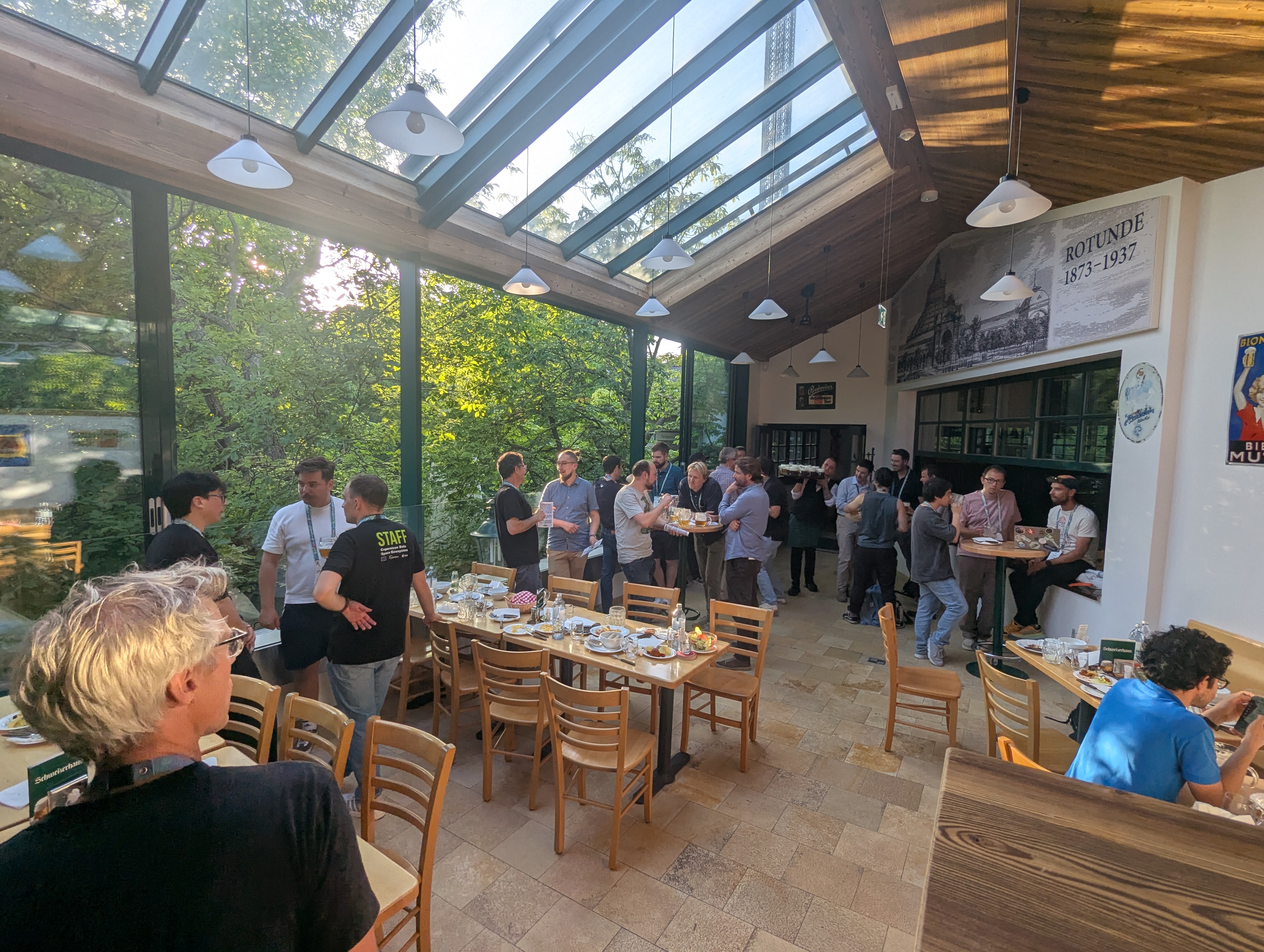
Fun fact… the tower that you can see through the skylight windows is the Prater Turm, one of the tallest swing rides in the world at 117 meters.
Takeaways
Below are my takeaways from the week, from the perspective of someone who has attended the last 4 LPS events:
Earth Observation data is underutilized. The opening plenary talks were fairly predictable, with a series of talks from ESA leaders on the benefits of everyone’s work. But this plenary has some memorable moments, from the thunderous sound system (I think the venue was trying to show off) to the “this message was generated using Artificial Intelligence” video from the Austrian Federal Ministry of Innovation, Mobility, and Infrastructure (which was somewhere between weird and creepy). My favorite talk was from the UNOOSA Director, Aarti Holla-Maini, who focused on the need to break down barriers in order to get Earth observation into the hands of a far larger audience. The community is good at generating cool stuff, but less good at getting it into the hands of people who actually need it.
Hyperspectral is on the rise. Access to hyperspectral imagery is increasing with PRISMA from ASI (Italy), EnMap from DLR (Germany), and the planned CHIME mission from ESA. The narrow spectral band information available from these sensors is already powering innovations in soil mineralogy, water quality, green house gas monitoring, and land cover mapping. For many use cases, spectral resolution is more important than spatial or temporal resolution.
Foundation Models seem to be competing with themselves, under a questionable scoring system. The sessions on foundation models (FM) were very well attended, but I ended up being a bit disappointed. Many of the presentations described how their particular FM scored on a series of benchmark tests (good!) but then I also learned that most of these benchmarks are based on analyzing individual images rather than analyzing time series (which is more difficult and more interesting, at least to me). Furthermore, the optical images in the benchmark datasets are largely cloud-free. Sure your FM may earn high scores in cloud-free conditions, but those conditions are in no way representative of the real world, which is full of clouds, shadows, haze, and a host of other non-ideal conditions.
LPS was a missed opportunity for ESA to inform the user community about their transition to Zarr. For months before LPS I had been hearing about ESA’s plan to transition to using Zarr as their default format, produced by their new processing Earth Observation Processor Framework (EOPF).
“For the past decade, Copernicus Sentinel Data Processors have generated vast amounts of reliable, accurate Earth Observation data that has facilitated groundbreaking scientific research and innovative commercial applications. But as technology evolves, so too must the data formats being used. Which is why the European Space Agency (ESA) has launched the Earth Observation Processing Framework (EOPF) data format (Zarr). The new format aims to futureproof data from Copernicus Sentinel satellites missions by adopting a common, cloud-native and interoperable solution.”
- ESA EOPF Zarr SamplesThere had been a steady release of newsletters, webinars, samples and tutorials about EOPF and Zarr. So I was expecting that ESA would use LPS to make sure the community was aware of this upcoming change.
However, the reality was much different. Searching for “EOPF” in the LPS programme returns a total of 5 results:
- 3 demos (on Monday, Tuesday, Wednesday)
- 1 oral session and 1 poster session (on Thursday)
If someone wasn’t aware of EOPF and the planned transition to Zarr before attending LPS (which I assume describes most attendees), I think it is likely they left LPS with the same lack of understanding.
If you are just learning about this now, and do want to learn more, I’d recommend visiting https://zarr.eopf.copernicus.eu/ and joining the discussion forum at https://discourse.eopf.copernicus.eu/
LLMs have potential for expanding access to Earth observation. I’d like to wrap up by describing another unexpected surprise from LPS, but this one was quite positive. I happened to attend a presentation by Nikos Tziolas, a faculty member from the University of Florida, that showcased an experimental platform (GAIA bot) that allows farmers to find, analyze, and display satellite data for their fields using an LLM conversational interface paired with an interactive map. I loved how this approach drastically lowered the barrier to entry for working with Earth observation data, and I look forward to future examples of scientists/researchers teaching LLMs how to perform complex, domain specific tasks like this.
What’s next?
LPS is a great conference for learning about new trends and for forging new (and strengthening existing) connections. I wish it happened more frequently than once every 3 years, but maybe I look forward to it more because of the time between.
In the meantime, there is an active community discussing these topics at: https://cloudnativegeo.org/join
And if you find out more about EOPF and the Zarr transition, join the ongoing discussions at: https://discourse.eopf.copernicus.eu/
Our blog is open source. You can suggest edits on GitHub.